Despite the fact that Melbourne has a very high dependency on cars for transport, particularly in the outer suburban areas, with a total of 3.6 million private vehicles using 22,320 km (13,870 miles) of road, and one of the highest lengths of road per capita in the world, the city has an increasingly popular integrated public transport system based around extensive train, tram, bus and taxi systems.
In the 1940s, 25% of travellers used public transport but by 2003 it had declined to just 7.6%. The public transport system was privatised in 1999, symbolising the peak of the decline.
Through privatisation and successive governments persisting with auto-centric urban development into the C21, there have since been large increases in public transport patronage and the development of multi-modal transport solutions.

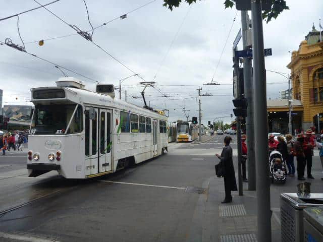
Rail / Tram interchange – Flinders St Station / Swanston St (2013)
Photo Credit: Helen Bainbridge MLA
Airport
The main passenger airport serving the metropolis is Melbourne Airport, which is the second busiest in Australia and also known as Tullamarine Airport. It was opened in 1970 to replace the nearby Essendon Airport. Melbourne Airport is the sole international airport of the four airports serving the Melbourne metropolitan area.
It comprises four terminals: one international terminal, two domestic terminals and one budget domestic terminal.
Railways
The Melbourne rail network has its origins in privately built lines from the 1850s gold rush era.
The first steam-operated trains and railway in Australia was established by the Melbourne and Hobson’s Bay Railway Company in 1854. The single line ran from Flinders Street to a pier at Sandridge (Port Melbourne), a distance of approximately 4km (2.5m.), opened by Governor Sir Charles Hotham in 1854.
The entire railway system became electric by 1923.
The city has rail connections with regional Victorian cities, as well as direct interstate rail services to Sydney and Adelaide.
During the 2008–2009, the city’s rail network recorded 213.9 million passenger trips, the highest in its history. Many rail lines, along with dedicated lines and rail yards are also used for freight.
Today the suburban network consists of 200 suburban stations on 16 lines which radiate from the City Loop, a partially underground metro section of the network beneath the Central Business District (Hoddle Grid).
What the City of Melbourne describes as
“… landmark infrastructure project designed to remove major bottlenecks in Victoria’s rail network…”
is currently underway via the Regional Rail Link project that
“…will increase the size of Victoria’s rail network by laying 90km of new track.”
The project is jointly funded by the Australian and Victorian governments, with the Commonwealth contributing $3.225 billion and the Victorian Government contributing $1.582 billion.
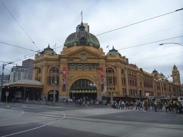
Flinders Street Station
Flinders Street Station is the city’s busiest railway station and was the world’s busiest passenger station in 1926. It remains a prominent landmark and meeting place.

Flinders St Station (2013)
Photo Credit: Helen Bainbridge MLA
As described by the City of Melbourne
“…Before Federation Square took the honours, Flinders Street Station was Melbourne’s favourite meeting place…
Flinders Street Station is Australia’s oldest train station, and with its distinctive yellow facade and green copper dome it’s a city icon. Takeaway stands line the concourse, and the upper floors were purpose-built to house a library, gym and a lecture hall, later used as a ballroom.
Flinders Street is the busiest suburban railway station in the southern hemisphere, with over 1500 trains and 110,000 commuters passing through each day. Listed on the Victorian Heritage Register, its 708m. main platform is the fourth longest railway platform in the world…”
Southern Cross Station
Southern Cross station is the principal inter-state train and bus interchange in the city.
Underground railway
In the early 1970s, digging commenced on the first tunnels for the Melbourne Underground Rail Loop line (now called the City Loop) and was completed in 1986.
Today, the Melbourne Metro Project (Metro Rail Capacity Project) involves the construction of a 9km. rail tunnel through inner Melbourne.
Public Transport Victoria have announced that
“…The Metro Rail Capacity Project is a critical city-shaping project that will overhaul Melbourne’s rail network, resulting in major improvements in capacity, reliability and travel times across the bulk of the metropolitan rail lines.
In November 2013, the Melbourne Metro project was officially renamed as the Metro Rail Capacity Project. The new name better reflects the significant capacity benefits that the project will provide to the Sunbury, Upfield, Craigieburn, Pakenham, Cranbourne, Sandringham, Frankston, Werribee and Williamstown lines. On day one the project will enable an additional 20,000 passangers to travel on Melbourne’s rail network in the peak hour, as well as relieving congestion on St Kilda road trams.
The project will also release freight and V/Line capacity between South Yarra and the city and will enable the delivery of the South East Rail Link (SERL)…”
Trams
Melbourne now has the largest tram network in the world which had its origins in the city’s 1880s land boom.
The first cable tramway was opened in 1885 and ran from the corner of Spencer and Flinders streets to Richmond. In 1886, to permit the extension of the cable-tram lines to Collins Street, the Bourke and Wills Monument was removed from the corner of Russell and Collins streets and repositioned in Spring Street.
By 1887, more than 32km of tramway system had been constructed. The Crown Law offices in Lonsdale Street and the Railway Offices in Spencer Street were then built.
In 1906, the first electric tram service was introduced to the suburbs and operated from the cable-tram terminus at Flemington. The conversion of all cable trams to electric trams commenced in 1925 and finished in the late-1930s.
Today it has the country’s only tram network to comprise more than a single line and consists of 250 km. of track, 487 trams, 28 routes, and 1,773 tram stops. Sections of the tram network are on roads, while others are separated or are light rail routes. Melbourne’s trams are recognised as cultural assets and a tourist attraction.
Heritage trams operate on Public Transport Victoria’s free City Circle route, intended for visitors to Melbourne, and heritage restaurant trams travel through the city and surrounding areas during the evening.

Bourke Rd Mall / Tramlines (2013)
Photo Credit: Helen Bainbridge MLA
Buses
Melbourne’s bus network consists of almost 300 routes which mainly service the outer suburbs and fill the gaps in the network between rail and tram services.
Port
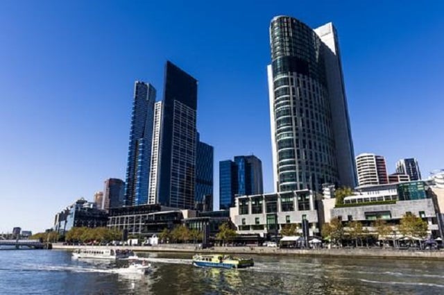
The Port of Melbourne is the country’s busiest seaport for containerised and general cargo. Ship transport is also a key part of the city’s public transport system. Station Pier on Port Phillip Bay is the main passenger ship terminal with cruise ships and the Spirit of Tasmania ferries which cross the Bass Strait to Tasmania docking there. Ferries and water taxis run from berths along the Yarra River as far upstream as South Yarra and across Port Phillip Bay.

Water taxi on the Yarra
[Image Source]
Cycling
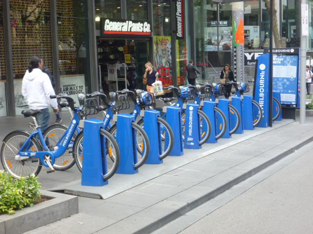
The city also has a bicycle sharing system established in 2010, which uses a network of marked road lanes and segregated cycle facilities.

Bicycle Lane – Swanston St (2013)
Photo Credit: Helen Bainbridge MLA
Read also Part 1: http://constructionshows.com/melbourne-garden-city-part-1-historical-development/2610501
Author: Mary Bon
Mary is a RIBA accredited architectural researcher, with previous international experience in architectural practice. She has proven research and writing experience for both established clients and innovative start-ups in the construction industry worldwide. She is now based in France and orientated towards bridging the gap between landscape and architecture whilst supporting the causes of local, national and international built and natural heritage.
 Constructionshows